|
|
Background
information
The key principle is to make the best possible use of the farm’s resources by targeting areas which give the best return for effort (time and money) to maximise nutrient and water use. Sometimes this will involve building on the strengths in one area of the farm, and at others it will mean targeting weaknesses.
For example, fertiliser will give the greatest economic return if you apply it to paddocks with the most responsive pasture species (ie, legumes rather than grasses and introduced pasture species rather than natives) and responsive livestock enterprises (eg, ewes and lambs rather than wethers). On the other hand, if you are trying to increase groundcover (to reduce soil erosion, water movement and nutrient loss), start with those areas that have the lowest levels.
|
|
 |
 |
Identify and understand the different soil types on your property and manage them appropriately
|
|
Make a simple farm map to help build a picture of your resources so you can prioritise your efforts |
|
 |
Key decisions, critical actions and benchmarks
Doing the right thing, in the right place at the right time means knowing where different soil types are, and managing them appropriately. For example, whether or not to fertilise (if so, how much and when - see procedure 7.1 in Grow More Pasture); where and how to sow introduced pastures or plant crops (see procedure 7.3 in Grow More Pasture); how to graze (crash grazing, rotational or set stocking - see procedure 7.1 and tool 7.5 in Grow More Pasture); and such considerations as managing riparian zones, biodiversity, tree planting and groundcover levels (see procedure 5.3 in Protect Your Farm’s Natural Assets). Any difficult-to-manage areas such as drainage lines, areas prone to waterlogging, shallow soils and those where salinity, acidity or sodicity may be a problem, need to be identified.
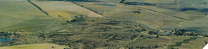
The most practical way of bringing all this soil and paddock based information together is to construct a farm map (see tool 6.1 for one way to do this). Or, if a farm map exists already, a series of plastic overlays can be made to show soil capability information (eg, soil types, depth, slope, fertility, identified problems, current use and productive potential). Often, this is simply a matter of recording existing knowledge about the farm, but it helps build a picture of your resources, allowing you to prioritise actions and inputs.
Ideally, the mapping exercise will provide a picture of the current productivity and potential for each paddock or land class, enabling sheep producers to assess the possibilities and limitations that their soils pose for their farm business. Most critically, does current or anticipated land use match land capability on a paddockby-paddock basis?
Farm maps can be supplemented with satellite images of your farm (available free from www.google.com/earth/). These can add additional insights into farm planning and align production goals with farm capability and productive potential.
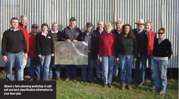
Sheep producers who want to take farm mapping and planning further than the relatively basic level outlined in tool 6.1, may find it useful to attend a farm planning workshop or to access soil and land classification surveys through their State Department of Primary Industries/Agriculture or local CMA or NRM body.
Signposts  |
View
Attend
PROfarm is the training program developed by NSW DPI to meet the needs of farmers, primary industries, agribusiness and the community. NSW DPI PROfarm short courses are available by contacting:
The PROfarm course most relevant to this procedure is Landscan®. This course will help you assess your natural resources to better match land use to land capability and to balance production, profit and sustainability.
Technical Colleges (TAFE) across Australia offer a range of whole farm planning workshops. Find your local college at: http://www.australianuniversities.com.au/colleges/list.php
Many catchment management authorities or regional NRM bodies sponsor whole-farm planning courses. Find your local organisation at: http://www.nrm.gov.au/about/nrm/regions/index.html
|
|