|
Preparing a Property Management Plan will be a systematic process. Different jurisdictions, and methodologies will have different processes and systems for preparing the plan.
There is more than one way to undertake the process of preparing a property management plan:
- You can attend a course or study through published literature and complete one yourself, using documented guidelines
- You can actively participate in the process, and feed information into the plan, and have a consultant prepare the plan
- State government departments may have specified guidelines, according to laws governing use of land, or access to funding to undertake projects. Be aware of the guidelines which exist in your area, so your plan will have multiple uses – this will save on time in the future.
Key elements that make up a property management plan are:
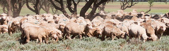
Paddock boundaries
Knowing or determining paddock size is an important part of this process, as it will be important in determining stocking rates and management options.
Land systems and catchments
Vegetation varies widely in response to differences in soil type and land form, which in turn determines the local distribution of water and nutrients in the system. Particular combinations of landforms/topography, vegetation and soils/geology form different ‘types’ of country which can be easily identified in the field and mapped by aerial photography. These distinctive types of country are known as land systems or land classes.
Understanding the land units and land systems that make up a property is essential to effectively managing a grazing enterprise. A land system is an area or group of areas through which there is a recurring pattern of topography, soils and vegetation. Land systems are made up of components, and are able to be described or identified due to a unique combination of land units and their relative proportions.
Similar vegetation types have similar management requirements and hence it is usual to fence similar land systems into the same paddock. Paddocks that have a diverse mix of land systems are often difficult to manage; land systems that grow desirable plant types will be susceptible to overgrazing, whilst land systems that grow less palatable species will tend to be under-grazed. Consideration can be given to the relative susceptibility of land units and systems with respect to issues such as scrub encroachment, wind or water erosion, and consequently monitoring of these units and systems may be different.
Broad vegetation groups
The vegetation types present on your property can be documented on the map as follows:
- Plant species that are preferred by livestock or important for production
- Areas of shelter
- Areas where undesirable species may establish or increase noxious weeds or unpalatable invasive native shrub
- Areas of vegetation that have been modified by management e.g. clearing, water spreading, burning
- Areas of mulga (Acacia aneura) or other palatable browse species suitable for use as a drought reserve
- Areas susceptible to overgrazing, which usually contain some of the most productive and palatable species.
The location and condition of key infrastructure items
Include all key infrastructure, such as tracks and roads, houses and buildings, airstrips, livestock
handling facilities, shearing sheds, yards, paddock fences, laneways, trap yards/self-mustering
facilities, mills, tanks and troughs or dams and watercourses. Include in this inventory the
age, condition, importance, adequacy for the task, development needs, and potential for
improvement.
Land management issues
Your farm map should include any areas which cause problems, or are areas in need of remediation, as well as their priority for works to improve the paddock/area.
Given the diversity of the pastoral areas of Australia, and their unique management requirements, it is imperative that you are familiar with planning processes, and recommendations in your local area.
|